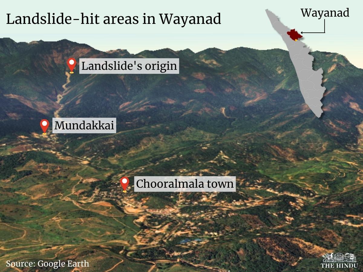
Drone image of Chooralmala in Wayanad district of Kerala, on August 1, 2024.
| Photo Credit: SPECIAL ARRANGEMENT
ISRO’s National Remote Sensing Centre (NRSC) has released high-resolution images taken by the space agency’s satellites which reveal the extensive damage caused by the landslip in Wayanad district in Kerala.
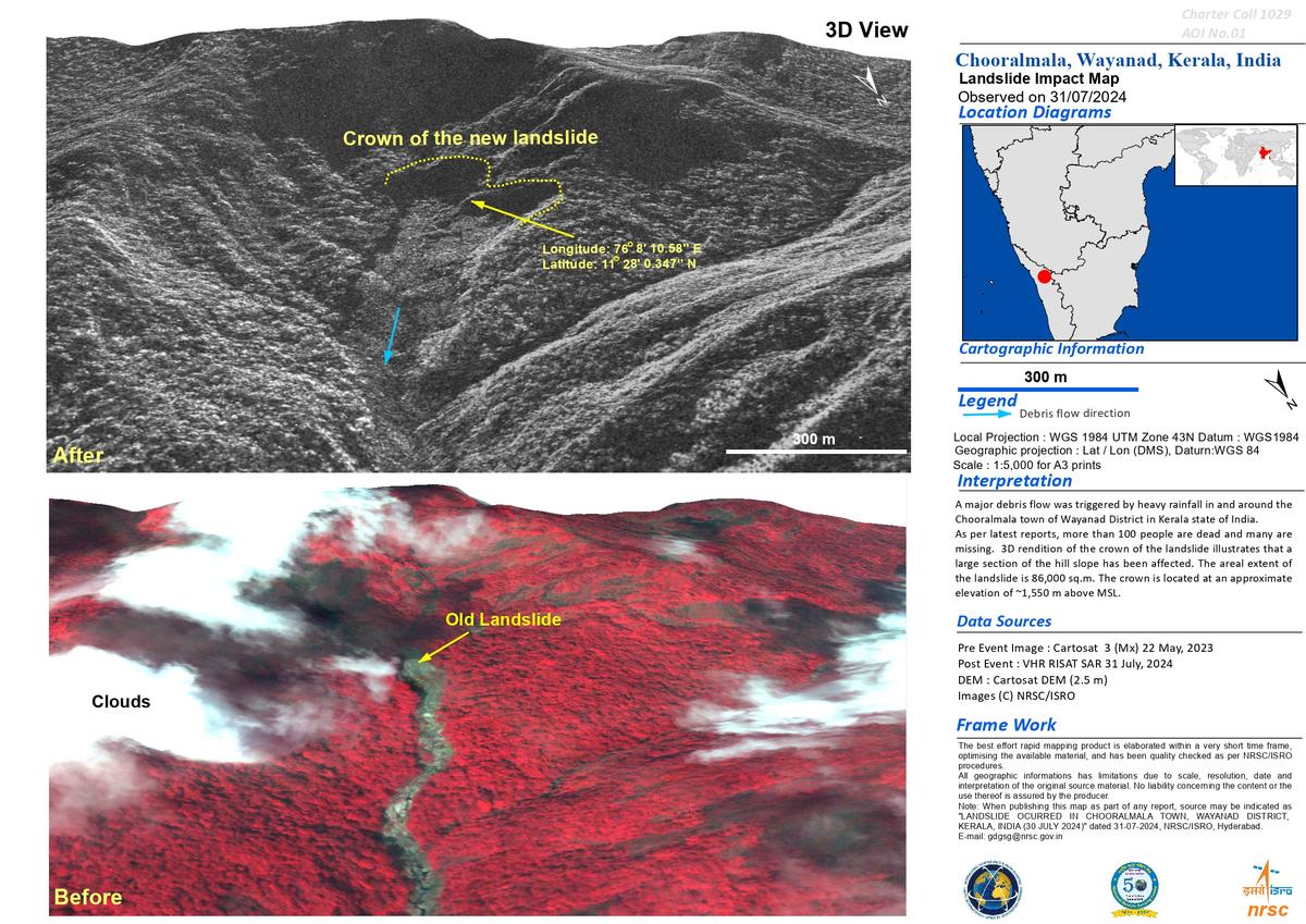
NRSC has released before and after images of Chooralmala in Wayanad district, which has been devastated by the July 30 landslide. The images show that about 86,000 square metres of land had slipped out of place.

Before and after images, released by NRSC of ISRO, of Chooralmala, in Wayanad district of Kerala, which was hit by a landslip on July 30, 2024.
| Photo Credit:
NRSC
While the pre-event images were captured by the Cartosat 3 satellite on May 22, 2023, the post event images were captured by the RISAT satellite a day after the landslip on July 31.
According to the images released by NRSC, there is evidence of an earlier landslip in the same location.

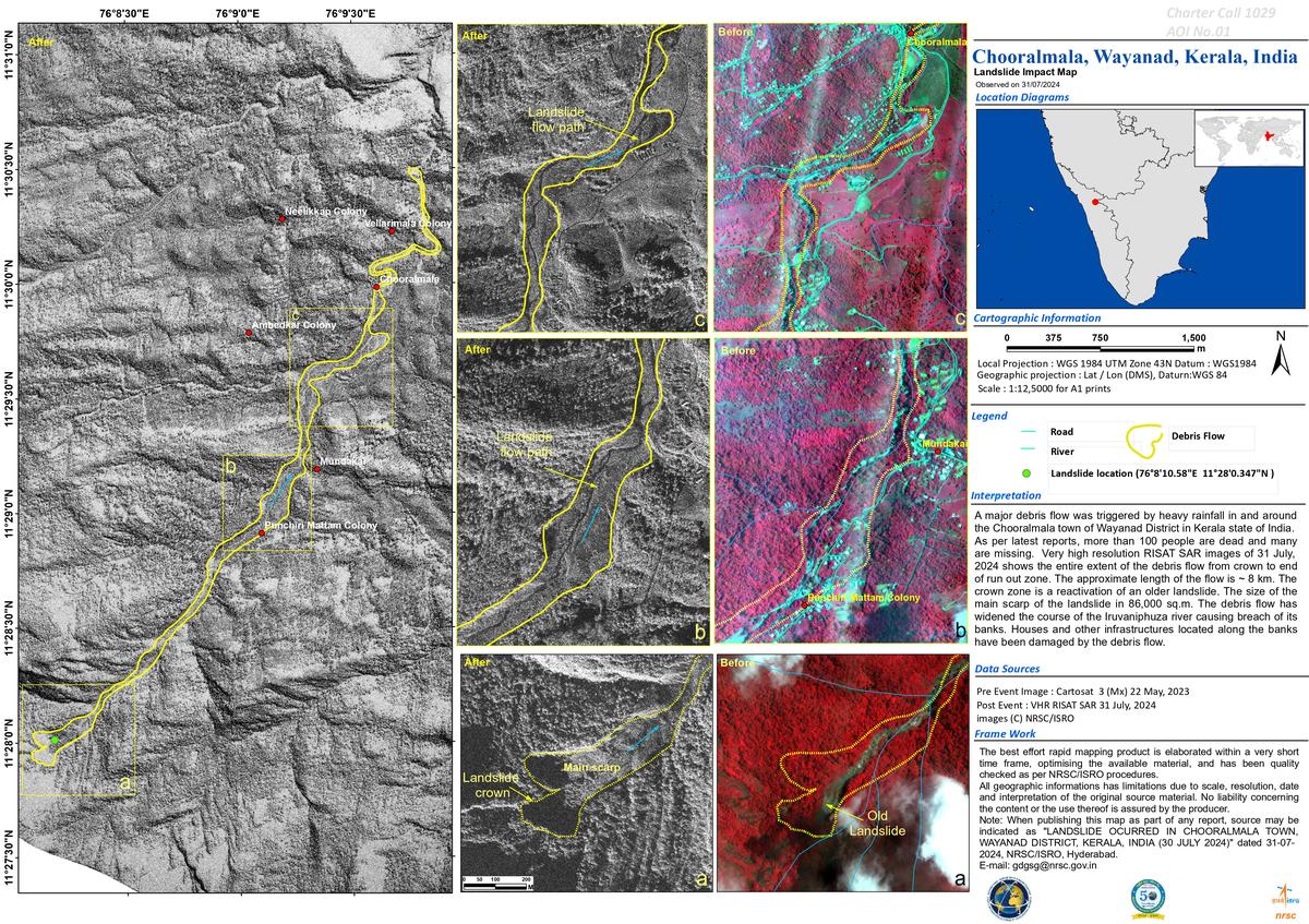
Interpreting the details of the image, NSRC states that a major flow of debris was triggered by heavy rainfall in and around Chooralmala.

An image released by NRSC of ISRO shows the landslide impact map of Chooralmala, in Wayanad district of Kerala. Chooralmala was hit by a landslip on July 30, 2024.
| Photo Credit:
NRSC
Very high resolution RISAT SAR images of July 31 show the entire extent of the debris flow from crown to end of the run-out zone. The approximate length of the flow is 8 km. The crown zone is a reactivation of an older landslide. The size of the main scrap of the landslide is 86,000 sq.m. The debris flow has widened the course of the Iruvaniphuza river, causing breach of its banks. Houses and other infrastructure located along the banks have been damaged by the debris flow, according to NRSC.

NRSC has the mandate for establishment of ground stations to receive satellite data, generate data products, disseminate to users, development of techniques for remote sensing applications, including disaster management support, geospatial services for good governance, and capacity building for professionals, faculty and students.
